
Saturday, March 26, 2011
Friday, March 25, 2011
After Kayak Drinks

Out to Sea

Floating

Heading Upriver

Rest Stop


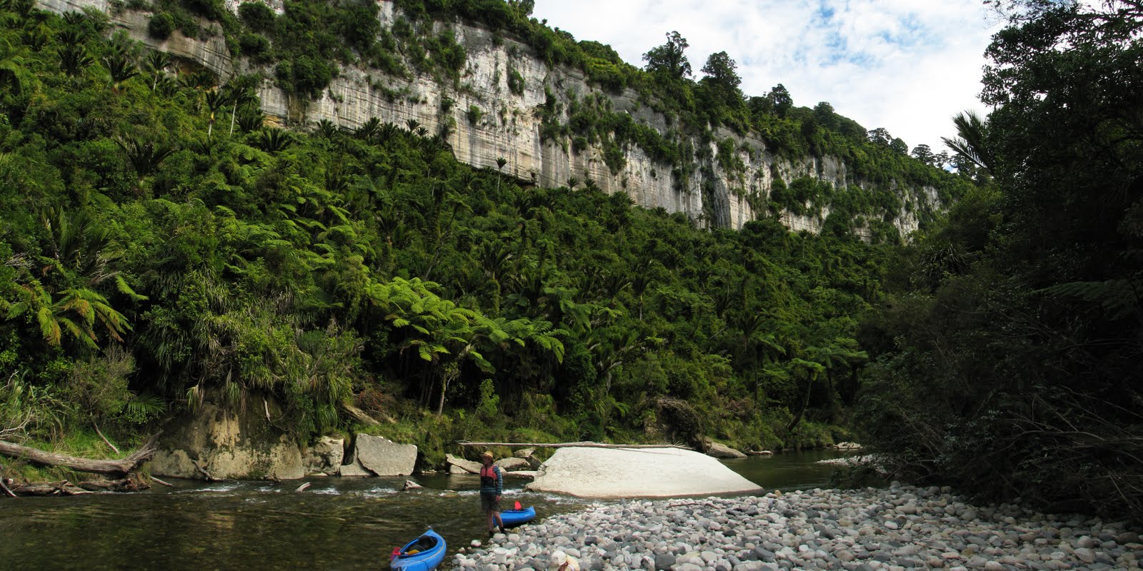
Kayaking

Thursday, March 24, 2011
Beachcomber

Room With A View


Wednesday, March 23, 2011


Paddling in a Lagoon

Tuesday, March 22, 2011


Monday, March 21, 2011


Would You Like Ice With That?


Ice Cave


Waterfall


Whataroa River

Sunday, March 20, 2011
Getting Away From it All

Sunday, March 13, 2011
Sightseeing


Another Chippy Bites the Dust


Sunday, March 06, 2011


Saturday, March 05, 2011

Still Standing (Just)


River Rd

10+
From wikipedia, this is the Modified Mercalli scale (MMI) which is used to measure the intensity of earthquakes. The quake last week was measured at 10+
- Instrumental: Not felt by many people unless in favourable conditions.
- Weak: Felt only by a few people at best, especially on the upper floors of buildings. Delicately suspended objects may swing.
- Slight: Felt quite noticeably by people indoors, especially on the upper floors of buildings. Many do not recognize it as an earthquake. Standing motor cars may rock slightly. Vibration similar to the passing of a truck. Duration estimated.
- Moderate: Felt indoors by many people, outdoors by few people during the day. At night, some awakened. Dishes, windows, doors disturbed; walls make cracking sound. Sensation like heavy truck striking building. Standing motor cars rock noticeably. Dishes and windows rattle alarmingly.
- Rather Strong: Felt outside by most, may not be felt by some outside in non-favourable conditions. Dishes and windows may break and large bells will ring. Vibrations like large train passing close to house.
- Strong: Felt by all; many frightened and run outdoors, walk unsteadily. Windows, dishes, glassware broken; books fall off shelves; some heavy furniture moved or overturned; a few instances of fallen plaster. Damage slight.
- Very Strong: Difficult to stand; furniture broken; damage negligible in building of good design and construction; slight to moderate in well-built ordinary structures; considerable damage in poorly built or badly designed structures; some chimneys broken. Noticed by people driving motor cars.
- Destructive: Damage slight in specially designed structures; considerable in ordinary substantial buildings with partial collapse. Damage great in poorly built structures. Fall of chimneys, factory stacks, columns, monuments, walls. Heavy furniture moved.
- Violent: General panic; damage considerable in specially designed structures, well designed frame structures thrown out of plumb. Damage great in substantial buildings, with partial collapse. Buildings shifted off foundations.
- Intense: Some well built wooden structures destroyed; most masonry and frame structures destroyed with foundation. Rails bent.
- Extreme: Few, if any masonry structures remain standing. Bridges destroyed. Rails bent greatly.
- Cataclysmic: Total destruction - Everything is destroyed. Lines of sight and level distorted. Objects thrown into the air. The ground moves in waves or ripples. Large amounts of rock move position. Landscape altered, or leveled by several meters. In some cases, even the routes of rivers are changed.
The force of the quake was "statistically unlikely" to occur more than once in 1000 years, according to one seismic engineer, with a PGA (peak ground acceleration) greater than many modern buildings were designed to withstand. The acceleration experienced in February 2011 would "totally flatten" most world cities, causing massive loss of life; in Christchurch, New Zealand's stringent building codes limited the disaster.
If you live in L.A. you might want to read this.
If you live in L.A. you might want to read this.
Friday, March 04, 2011
The Big Picture

The big aftershock last week was unprecedented. The latest info suggests that it may have been the most violent earthquake to have ever hit a built up area anywhere in the world. The magnitude was not especially large but several factors combined to exaggerate its power. First, it was very close to the city and very shallow. Second, the liquefaction that occurred enhanced the shaking. Third, the port hills (the NW edge of banks peninsula that mark the southern boundary of the city and are mostly dense basalt) acted as a lens, focusing the seismic energy onto the central city.
This is borne out by the data. At the epicentre of the much larger September quake, the peak ground acceleration (PGA) was 1.26g. In the Haiti earthquake that killed a quarter of a million people the PGA was 0.5g. During the earthquake that hit us last week, most of the city experienced a PGA of 2.2g and the ground was shaking side to side by a metre. The port hills now stand 50cm higher and 50cm westward than before.
The New Zealand building code is one of the strictest in the world. Buildings must be able to withstand a PGA of 0.7g. We experienced over three times that and it is no surprise that so much of the city has been destroyed. The only factor that worked in our favour is that the magnitude of the aftershock was only 6.3. This resulted in a shorter quake that lasted about 20 seconds whereas the September quake lasted 50 seconds.
Subscribe to:
Comments (Atom)